

STANDALONE TRAIL MAP
TRAIL INFORMATION

Red Warrior Tr. No. 152
// track pieces: 231, // elevation pieces: 231
Details
| Status: | Partial |
| Difficulty: | Advanced |
| Uses: | Mt Biking & Hiking & Equestrian & Motorcycle & eBikes |
| Length: | 8.1 miles |
| Start: | 6,314' |
| End: | 7,379' |
| Min: | 6,314' |
| Max: | 8,350' |
| Gain: | 2,344' |
| Loss: | -1,279' |
| fly your trail in 3D | |
 |
Google Earth KML file
Download KML file above, open in Google Earth to see this trail in 3D! |
| don't get lost |
| GPX file (right click to download)
Download GPX file above, upload the track to your GPS or smartphone and you'll always know where you are!! |
Trailhead Forecast
Snowfall
New Snow last 12 hours: 0.34". New Snow last 24 hours: 0.8".Description / Access Information
Red Warrior Tr. No. 152: Like Warfield Creek to the west, the headwaters of Red Warrior were badly burned in 2007. Trail re-routes completed in 2010 by The Ketchum Ranger District vastly improved the hiking and biking possibilities between these two drainages.
Burned trees often come down across the trail during storms and wind events. Big thanks to the motorcyclists in the valley who do so much work cutting them out over and over again.
At the north end of the trail, at Warm Springs Road, there is no bridge across Warm Springs Creek. In the springtime the creek may be running high. The creek is not safe to cross when the the water is running high and fast.
Forming a loop by using Red Warrior and the Warfield Tr. No. 151 is a popular and varied route; a great way to explore these parallel canyons.
Directions: From Ketchum, head west on Warm Springs Road and follow it to the end of the pavement (4.8 mi). Stay on the main dirt road to the sign for Red Warrior just past Frenchman’s Hot Springs (6.1 mi). There is only room for a couple of vehicles to park here at the creek crossing and base of the trail. Additional parking can be found in a large wide area in the Warm Springs Road; its another 0.1 miles west of the trail/road intersection.
Photos
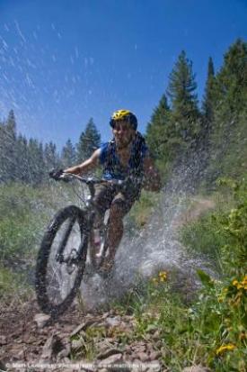 |
| Crossing a small side creek along the Red Warrior Tr. |


